

This was supposed to be a day spent hiking in The Needles section of Canyonlands National Park, the gnat clouds had sent us fleeing out of the park and up to a camp site at a higher elevation where the little buggers could not bother us; which meant that we were now essentially winging it. You gotta be flexible when traveling on the road.

The bright sun woke us from our sleep and we rolled out of our sleeping bags and started leisurely packing our camping gear away in the SUV. Breakfast was peaches and apple juice as we watched several hawks engaged in an aerial ballet on the Sky TV channel. The unobstructed views went on forever and the silence was so deep that it literally felt like we had lost our hearing. I couldn’t remember the last time I had heard such blessed quiet.

We headed back to old reliable US 191 and turned south toward the Abajo Mountains as the Manti-La Sal Mountains to the east blazed a bright yellow in the morning light.

Monticello
Located between two large mountain ranges – the Abajos and LaSals – Monticello, Utah sits in their rain shadows, begging for rain that comes ever so close but rarely delivers.

Our first impromptu stop was the pueblo-style Canyon Country Discovery Center, located right off US 191 just before Monticello. The entrance fee was a very reasonable $6.

We chatted it up with the very animated young lady who ran the place. She was born and raised in Monticello and recommended several cool-sounding side trips for us to do that day.
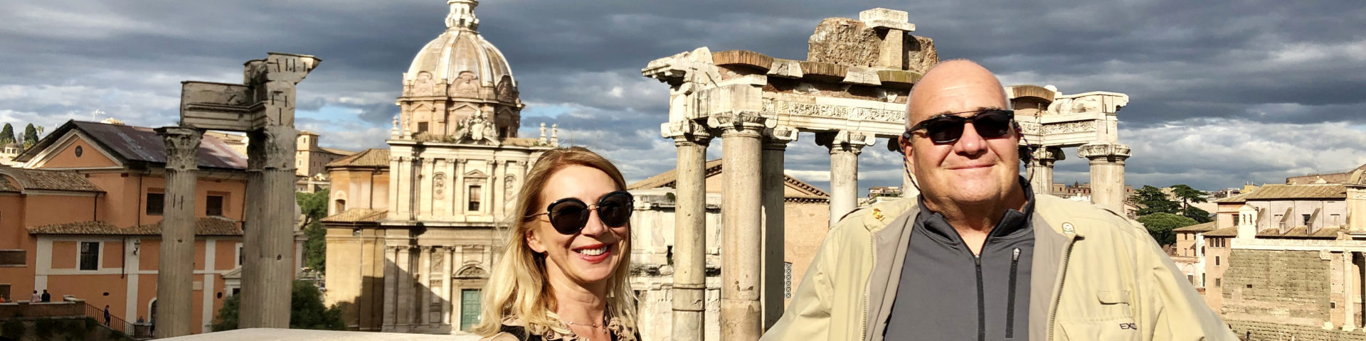
 Photo Courtesy of www.utah.com
Inside the museum, there was a sunny, light-filled room filled with very interesting interactive science exhibits geared for kids and curious adults about wind, light, water, minerals and animals. There were classrooms, a planetarium, a climbing wall, and a quiet meditation area overlooking a serene desert pond. They also had a nice gift shop selling outdoor equipment and snacks. The bathrooms were clean and spacious bathroom. The Wi-Fi was free. And outside, there were picnic shelters with grills and a trippy playground and rock garden.

Photo Courtesy of www.utah.com
We spent a very enjoyable hour cruising around the Discovery Center, then headed for town and checked into the Rodeway Inn & Suites on the north end of town. The place was a bit shabby but they had a great indoor pool. It was going to be another scorcher, so that would definitely come in handy later on in the day.

The first thing we saw as we approached Monticello from the north was a large wind farm in the foothills of the Abajos running right down to the western edge of town like a large flock of white-winged dinosaur birds perched above a green oasis in the high desert.

We hadn’t eaten a hot meal since the Quesadilla Mobillia in Moab the previous afternoon, so it was time to chow down. We were pleasantly surprised to find another Peace Tree Cafe located in a little yellow house surrounded by tall cottonwoods in the middle of the sleepy Mormon town and the Native-Americans running the place treated us like long-lost friends. The breakfast was delicious!

Abajo Mountains
Following the directions that we had been given by the friendly lass at the Discovery Center, we took an amazing drive to the very top of the Abajo Mountains, following 200 West and Abajo Road out of town and then turning left after Dalton Springs where there was a sign to Lloyd’s Lake.

The gravel road climbed steeply through Gambel oak, and then aspen and conifer forests before rising above the tree line into a surreal alpine zone where large pieces of shattered brown rectangular Laccolith rock blocks looked like they had been dumped across the face of the lush green-meadow mountains that surprisingly resembled the Alps. The road was suitable for a SUV, and maybe a passenger car with high clearance, but was definitely not for the faint of heart because there was a sheer drop of at least a thousand feet on the left side of the narrow, steep cobble-littered road, and there were no barriers for the last mile up to the summit. If you got too close to the edge, that’s all she wrote.

At the top there was a communication complex of cell towers and barely room to park, but we squeezed our vehicle into a space between two spruce trees and the views from the tippy-top were absolutely stunning.


On the way back down from Abajo Peak we stopped at Lloyd’s Lake for a short hike around the shoreline. The only other person around was a lone fishermen, sitting in a lawn chair half asleep.

The Visitor Center was located right in the middle of town off Main Street (US 191), and attached to the center was the FREE! Frontier Museum where they showcased a very curious mix, starting with the standard private collections of looted Indian artifacts from Anasazi sites in the area, with the names of the pot hunters, like Nell Dalton, proudly displayed like generous benefactors; items like linens and dishes from the long-gone Hyland Hotel; a wooden chair from the Home of Truth Chapel; minerals, fossils, and monstrous sharks teeth; a Champion Cowboy saddle; a galvanized steel ballot box; Ray Jarvis’ old tool collection; landline telephones and the town’s first switchboard; a white oven/stove and gas iron; a huge typewriter; old dresses and a baby carriage; an electric mangler and all things cowboy; historic photos of cowboys and Indians; a very odd doll collection; medical equipment, including a weird EKG machine; a collection of barbed wire; cameras, radios, and a hodgepodge mix of unrelated items from local houses and businesses.

One of the more interesting items in the Frontier Museum was the Bull Durham Tobacco Quilt that was made from old Bull Durham sacks by a local lady who collected them along the side of the road and from the local cowboys who saved their sacks for her too. When she had collected enough, she dyed them yellow and pink and made two lovely quilts. The quilter was following the pioneer creed: “Use It Up, Wear It Out, Make Do Or Do Without”.

But the strangest exhibit were items donated by the family of Marie Ogden of New Jersey, who came to San Juan County in 1933 after the death of her husband, with a group of about thirty followers who called themselves The Home of Truth. They were mostly disillusioned easterners who were fleeing the Great Depression and they were following Marie who had promised to lead them to the place of the Second Coming of Jesús Christ. Marie’s followers believed she was the reincarnation of the Virgin Mary. Apparently, the local Mormons did not find these religious fanatics amusing and no one would sell them land around Monticello. But Marie was tenacious and she built her mission by a creek near what is today the entrance to The Needles section of Canyonlands National Park. And then she bought the “San Juan Record” newspaper in 1934 and served as its editor until 1949 when she sold the paper. She also tried her hand at farming, mining, construction projects, and taught music. She died in a nursing home in Blanding, Utah in 1975, at the age of 91.

It only took us about thirty minutes to check out the museum, and after that, we chatted it up with the ladies who ran the Visitor Center. The neatest thing in the whole place was “Little Town”, an amazing diorama of Monticello between 1888-1911.

And as we were leaving, one of the ladies led us outside to an adjacent barn where she showed us the ginormous 20-feet-long by ten-feet-wide by eleven-feet-high, 650 rpm, 22,725-pound, 4-cylinder gas tractor called the “Big Four “30” – The Giant Horse” made in 1913 by the Emerson-Brantingham Company of Minneapolis. It is a remnant of olden days when colossus machinery ruled the day.

The initial cost of this behemoth that moved along at a top speed of 3 mph and needed a full time maintenance crew, was $4,000, a hefty price indeed in those days for a little shitkicker town in the middle of nowhere. But the local working wage per day was $11.20, and the total cost for using the Big Four tractor in grubbing and plowing was $3.51. So it was a good deal – at least for a few years, until it started regularly breaking down. Eventually, they just dug a big hole out in the desert and buried the goddamn thing.

Whenever you are passing through places you once visited, it’s always fun to stop and re-live your memories. The last time I had been to Monticello was when I got popped for weed and an open container at a road block near Natural Bridges on a Labor Day weekend way back in the early 90’s, and ended up spending the night in the brand new Monticello Jail. So, we pulled over and Jimmy snapped a photo for posterity of me standing in the road in front of the jail.

After spending some time cooling down in the motel pool, we ate a thoroughly forgettable meal at a local burger joint called PJ’s Burgers. Our only other choice was Wagon Wheel Pizza which looked like they were serving wagon wheels covered with cheese. Like I said before, sometimes you just have to roll with the punches when you’re traveling.

The International Dark-Sky Association works to protect the night skies for present and future generations, and they produce a map each year showing light pollution zones around the globe. They also designate “Dark-Sky Parks”, of which Canyonlands is one. So, star gazing in southeastern Utah is pretty stellar (bad pun intended), and we took advantage of it almost every night by driving out into the high desert and watching the stars for a few hours while drinking a few frosty beverages.

So, as the sun began to set we drove north, past tidy, well-watered farms and small ranches until we came to a U.S. Forest Service sign for the Spring Creek Road. As far as the eye could see was public land and there were no houses or structures. We turned left, following a dry creek bed, and after about two miles we came to narrow gravel road leading up to a pinyon/juniper ridge overlooking Abajo Peak where we had driven earlier in the day. We had come full circle without rhyme or reason.

We set up the lawn chairs, broke out the cooler and relaxed in the evening’s outdoor patio. A pack of coyotes began singing their hunting song. And a jet plane headed south at 35,000 feet, still illuminated by the setting sun to the west like a golden arrow.

And right on cue, up popped the stars. After a week of star gazing, we now knew the brightest ones by name. As soon as darkness settled in, our old friend the Milky Way slowly came sparkling into view, looking like the galaxy’s biggest natural arch. And there was no entrance fee.

Next Stop – Mexican Hat
lasuna brand – buy lasuna paypal how to buy himcolin
order besifloxacin online cheap – buy carbocysteine pills sildamax medication
buy besivance without a prescription – carbocisteine usa buy sildamax online
gabapentin 600mg cost – motrin cost sulfasalazine canada
buy neurontin 800mg generic – motrin 400mg cost sulfasalazine 500mg pills
probenecid 500 mg drug – probenecid 500 mg sale tegretol 400mg brand
buy generic benemid over the counter – tegretol 400mg oral cost tegretol
celecoxib 100mg without prescription – buy celecoxib 100mg generic indomethacin 50mg
order mebeverine online – etoricoxib oral buy cheap cilostazol
buy generic celebrex 200mg – indomethacin 50mg over the counter indocin 50mg capsule
buy mebeverine 135 mg generic – buy generic pletal buy generic cilostazol online
cambia us – voltaren 50mg pills generic aspirin 75 mg
diclofenac price – aspirin canada aspirin drug
rumalaya over the counter – buy shallaki sale buy elavil tablets
buy rumalaya paypal – buy amitriptyline without prescription purchase elavil sale
buy pyridostigmine pills for sale – buy pyridostigmine 60 mg online cheap buy imuran without prescription
cheap pyridostigmine 60mg – order imuran 25mg without prescription buy azathioprine 25mg online
buy acyclovir 800mg sale – buy zovirax 800mg for sale crestor 20mg cheap
buy generic motilium online – motilium 10mg oral cheap flexeril 15mg
buy domperidone 10mg generic – order sumycin 250mg sale order generic flexeril 15mg
motilium 10mg pill – motilium pill flexeril price
motilium 10mg usa – purchase motilium buy flexeril for sale
order inderal 10mg generic – order clopidogrel 75mg online cheap methotrexate 2.5mg us
buy propranolol generic – plavix 75mg usa buy cheap methotrexate
purchase coumadin without prescription – medex oral buy losartan 25mg without prescription
buy warfarin 2mg online – order losartan 25mg for sale where to buy hyzaar without a prescription
buy levaquin 250mg pills – buy levofloxacin 250mg without prescription purchase ranitidine sale
esomeprazole drug – purchase sumatriptan online cheap buy generic imitrex
buy nexium 40mg capsules – brand esomeprazole sumatriptan 50mg without prescription
brand mobic – celebrex order order flomax 0.4mg online cheap
buy mobic cheap – celebrex usa cost flomax 0.2mg
buy zofran without a prescription – buy ondansetron 8mg cost zocor 10mg
valacyclovir 1000mg ca – proscar 1mg us how to get diflucan without a prescription
purchase valacyclovir generic – valtrex 1000mg brand purchase diflucan online cheap
real money combines cute chicken antics with serious gambling rush! Step multipliers create explosive win moments. Provably fair play ensures every crossing counts!
chicken road demo brings crash-style excitement with a fun twist: a determined chicken vs. deadly traps! Instant cash outs and soaring multipliers create endless replay value. Dive in and start crossing!
luckyland slots sign up bonus: The ultimate free social casino experience! Sign up for your bonus—7,777 Gold Coins and 10 Sweeps Coins await. Spin for fun and redeem Sweeps for real cash rewards!
Elevate your entertainment with abetmgm Casino. Unlock 100% deposit match up to $1,000 and $25 On The House instantly. Mobile gaming at its finest.
betmgm turns ordinary evenings into legendary nights. Sign up for 100% match up to $1,000 and $25 free play. Live casino fun delivered instantly.
Une pharmacie francaise en ligne, serieuse et fiable. Tous nos produits sont authentiques et issus de circuits officiels. Beneficiez d’une expedition soignee et discrete directement dans votre boite aux lettres. Parce que votre sante merite le meilleur.careconnectclinic
Votre pharmacie ouvre 24h/24 sur internet. Trouvez ce qu’il vous faut parmi des milliers de produits de sante. Paiement securise et livraison en point relais ou chez vous. La sante sans les contraintes.cleocin
FanDuel Casino is America’s #1 online casino, delivering constant thrills with ignition casino red room , aristocratic slots like Huff N’ Huff, and last dealer action sort out at your fingertips. Hip players get 500 Hand-out Spins plus $40 in Casino Bonus just for the purpose depositing $10—bonus up to $1,000 fail on first-day net losses. Line all Thrillionaires: unite for the nonce, vie with your way, and turn every blink into epic wins!
FanDuel Casino is America’s #1 online casino, delivering constant thrills with ignition casino blackjack , upper-class slots like Huff N’ Huff, and actual dealer force sort out at your fingertips. Hip players get 500 Largesse Spins supplementary $40 in Casino Perk exactly suited for depositing $10—added up to $1,000 fail on first-day reticle losses. Calling all Thrillionaires: be adjacent to minute, operate your nature, and construct every moment into epic wins!
Accurate and hopeful update on emerging therapies for spinal muscular atrophy. – https://beautyberoep.nl/beste-opleiding-schoonheidsspecialiste/ , The discussion on exercise as medicine is spot-on. Dose-response relationships are becoming clearer. .